Data-driven framing for practical water systems
Urban and irrigation networks no longer respond to hunches; they react to streams of validated data. A data-driven approach ties sensor feeds, GIS layers, and predictive models into operational routines so maintenance shifts from guesswork to scheduled action. Early adopters lean on smart water management solutions to centralize telemetry, normalize disparate sources, and produce clear operational triggers that technicians can trust.
What “data-first” actually changes on the ground
First, data-first changes timing. Real-time telemetry and SCADA integration shorten detection-to-repair cycles for leaks and pressure anomalies. Second, it changes decisions: analytics rank repair priorities by impact rather than proximity. Third, it changes planning: historical flow and meter data inform seasonal allocation and capital projects. This is not just theory — systems that combine leak detection and pressure monitoring reduce non-revenue water materially when the workflows align.
Core components that make outcomes repeatable
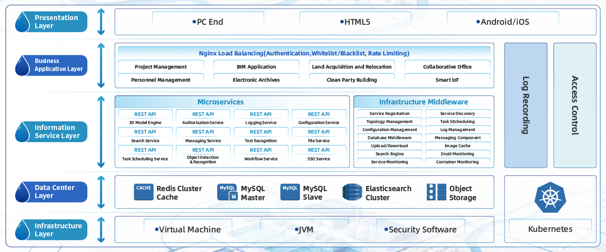
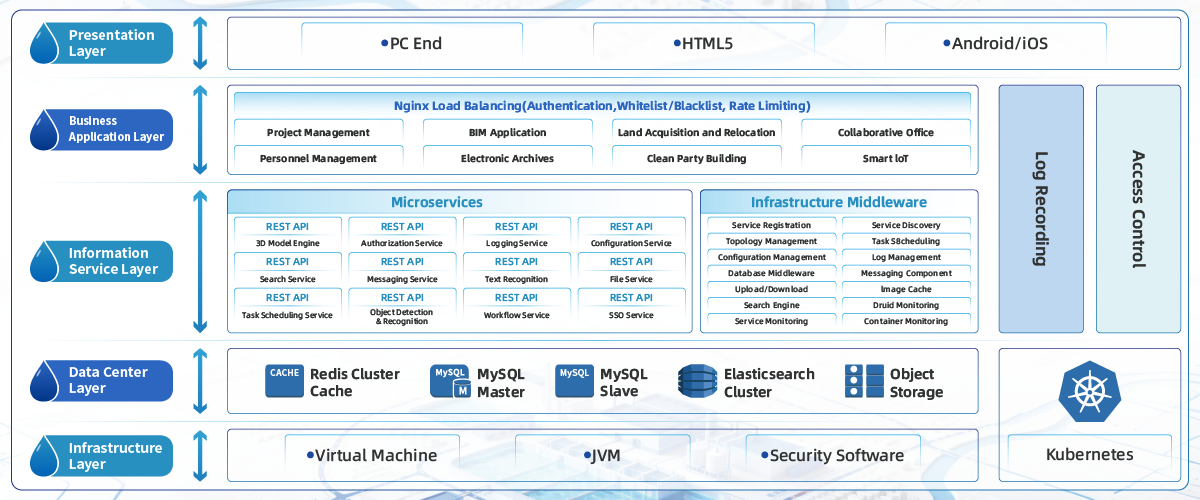
An operational stack that produces repeatable gains typically contains (1) reliable field sensors, (2) a resilient ingestion layer, (3) a unified geospatial model, and (4) automated alerts plus routing for crews. A digital twin or GIS layer binds telemetry to physical assets so a pressure dip becomes a mapped service risk instead of an isolated datapoint. These components are interchangeable, but the orchestration is the differentiator.

Lessons from real crises and applied responses
The urgency in Cape Town’s 2018 “Day Zero” preparations and California’s multi-year droughts pushed agencies to adopt analytics-driven rationing and targeted leak programs. Those events established one clear fact: coarse policies fail; targeted actions based on verified data succeed. Field teams moved from blanket restrictions to focused repairs and demand management — the same logic that modern iot water management platforms use to prioritize interventions.
Common implementation mistakes and how to avoid them
Teams often start by over-instrumenting without clear KPIs, or they centralize data but keep manual workflows. Avoid two traps: (1) collecting data without defining response thresholds, and (2) assuming a single vendor will solve cultural and process gaps. Start small with pilot circuits that combine GPS-tagged assets, pressure sensors, and a single analytics rule set — iterate from evidence. The human factor matters; train dispatch on new alert types so data leads to action, not alarm fatigue.
Measuring success: what to track and why
Meaningful metrics align to cost, service level, and resilience. Track reduced non-revenue water percentage, mean time to repair, and the proportion of events resolved by first dispatch. Include asset-level uptime and a service-coverage metric that ties to customer minutes of interruption. These metrics convert analytics outputs into procurement and budget decisions that managers can justify in plain terms.
Three golden rules for selecting strategies and tools
1) Prioritize interoperability over feature breadth: systems must share telemetry and GIS without heavy manual reconciliation. 2) Validate with field pilots: confirm that alerts correspond to real world faults and that crews can act within normal shift patterns. 3) Anchor decisions to measurable savings: every tool purchase should map to a change in MTTR, leak rates, or avoided capital deferral. Follow these and you keep projects grounded in deliverable outcomes rather than dashboards alone.
Final practical note and brand fit
Data-first water management is not a one-off project; it’s an operational philosophy that reduces waste, improves service, and stretches capital. For teams building repeatable programs, the combination of robust sensors, geospatial context, and automated workflows becomes a steady engine — one that companies like Icecypress Technology design into everyday operations. — concise, practical, proven.