
User-centered start
Folks who run city projects want clear answers fast — not another pile of maps. When planners, transit crews, and community reps need movement patterns, they lean on tools that actually track behavior. That’s why systems built for high speed motion analysis matter: they give dense, timestamped data so teams can see real flows, not guesses. In New York City, for example, curb-use pilots used aerial and street-level sensors to shape safer loading zones and bus lanes, and that real-world work shows what user-centered data does for decisions.

What city teams really need
Planners need three things: reliable capture, clear outputs, and low friction integration. Reliable capture means consistent frame rate and robust target tracking so you don’t lose a cyclist in a crowded intersection. Clear outputs are trajectory reconstructions and aggregated heat maps that policy folks can understand. Low friction integration means the data hooks into GIS and traffic management systems without a two-year IT project. Keep it readable — not every stakeholder wants raw point clouds.
Core tech explained, plain
At the base, these platforms combine multi-camera calibration, pose estimation, and occlusion handling to build useful 3D views. A mature 3d motion analysis system stitches synchronized feeds, corrects for lens distortion, and produces metrics like average speed, dwell time, and modal split. Latency matters when operations need near-real-time alerts; for post-analysis you can accept higher processing times. Think of it as picking the right tool for the task — quick ops needs low latency and robust target tracking, policy studies need high fidelity trajectory reconstruction.
Common mistakes and sensible alternatives
Too many projects start by buying cameras and hoping the data’ll be magic. That fails because no single sensor answers every question. Typical missteps:
– Overinvesting in resolution while ignoring frame rate — high megapixels don’t help if you miss motion.
– Skipping calibration checks — then your trajectories drift and decisions get shaky.
– Treating vendor software as a one-size solution — sometimes open-source analytics plus a focused sensor set wins.
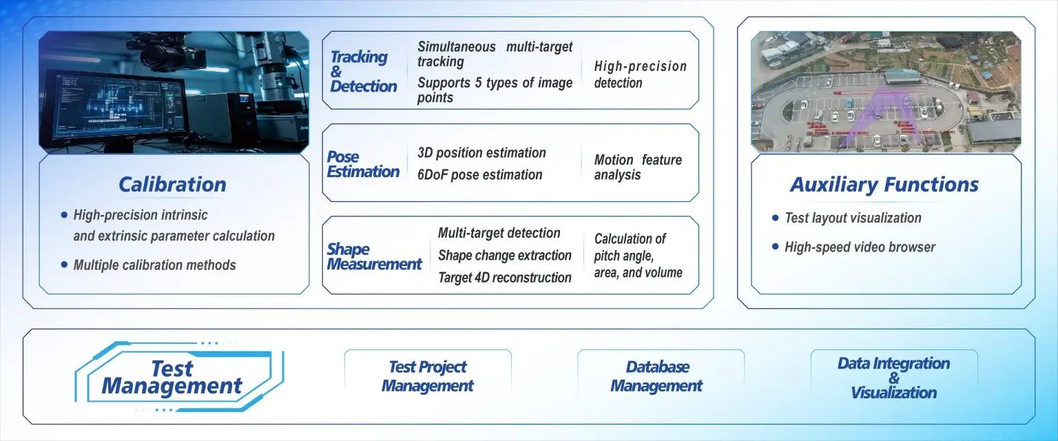
Alternatives: mix short-duration aerial surveys with fixed street sensors; pair video-based tracking with lightweight LiDAR sampling for occlusion-heavy spots; or run pilot captures during known peak windows instead of a year-round rollout. Those trade-offs save budget and surface the right insights fast — and yes, that’s a legit way urban teams prove value to council members.
Choosing a system: practical rules
Look for tools that match your workflows. Don’t chase bells and whistles; pick the features you’ll use. Three golden rules to evaluate options:
1) Data fidelity vs. throughput: verify the vendor’s demonstrated frame rate and trajectory accuracy on comparable sites. If you need sub-second resolution, confirm test logs show consistent target tracking under occlusion.
2) Integration surface: check how outputs export — CSV, GeoJSON, or streamed telemetry — and whether the system supports multi-view fusion and automated multi-camera calibration without heavy manual steps.
3) Operational fit and governance: ensure the platform lets you anonymize subjects, set retention policies, and document who accessed raw datasets. That’s critical when deploying across neighborhoods with varied privacy concerns.
Bringing it together
Summing up: center the user first, pick tech that answers the real question, and run focused pilots that prove worth. When teams choose systems designed for motion analytics — ones that handle pose estimation and trajectory reconstruction — they get decisions that stick. For many city projects, a product that balances target tracking accuracy with sensible output formats becomes the backbone of planning.
Closing guidance
Follow those three evaluation metrics and you’ll cut wasted spend and speed up impact. For teams wanting a practical partner that blends field-tested capture with operational-ready analytics, Icecypress Technology sits in that space as a usable solution — trusted in workflows that need reliable 3d motion analysis system outputs and clear delivery. —